NZ Hike Cape Brett (Thursday, February 25)
After a fortifying breakfast at a nice place on the harbor, we headed for the boat that would ferry us to our hiking spot for today. This place is named Bay of Islands and that’s a very accurate description. There are lots of them, of all sizes!
It was a bit of a challenge to decide what to put in my day pack since weight would be of the essence, but it was important to have the right stuff. Lina (correct spelling of our guide’s name) had advised us to take plenty of water since it would be hot, so I got an extra bottle. I also decided to take my rain jacket, not because we expected rain, but because of the boat ride.
And I was right! The ride was about 40 minutes, and despite it being a very warm day, the breeze and salt spray combined to make it a pretty chilly ride. I put on my jacket about 20 minutes into the ride.
At the island, the landing was a bit tricky. The boat had to cozy up to some rocks and we had to brave the surf to get onto them, then shimmy our way along a narrow edge through some plants to get to the rocky beach. That done with no mishaps, we said good-bye to the boat, which we were planning to meet at the end of the trek.
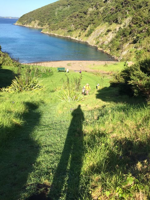
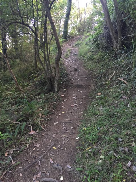
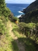
I said yesterday that I wasn’t looking forward to the climb up, but it really wasn’t that bad (so much for expectations, huh?). The elevation change was pretty substantial, as you can see from the look back to the beach (I’m the scarecrow shadow in the picture–no way to frame this shot from where the path was). After climbing through a long grass field, we started up into the forest.
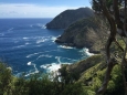
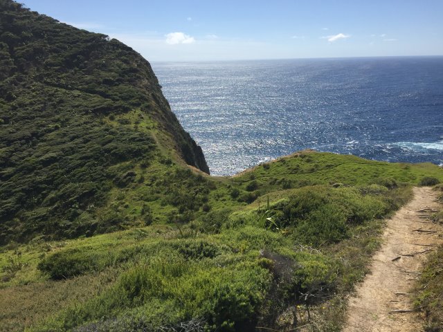
Our first real view came when we popped out of the trees on the other side of the island. Here you can get a good idea of the elevation change, as we’d been at sea level not too long before. The views were just stunning!
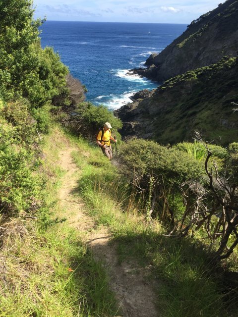
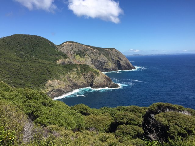
The trek was warm but after the initial up, seemed to be more level or downhill, as we wound our way around the island. The view coming out on yet another side of the island was beautiful. If you look closely, you should be able to make out where the path was going to climb up into the forest to the left. The last shoreline picture for today was looking back toward where we started, pretty much straight over the top of the two humps and down to the shore. Beautiful.
The surprise for today, though, was that when most of us were a couple of hours into the expected 2.5-hour hike–and were thinking we were within a half hour or so of being picked up at the other end–we were met by Dusty, the fist mate from the boat. Surprise! He came with news that the pick-up point was too dangerous for us to be picked up there. The swells were too high. He’d barely gotten to shore himself. Apparently Typhoon Winston was kicking up enough of a fuss west of us to raise the swells significantly.
So there was nothing to do but turn around and head back the way we’d come–back to the beach in the cove that was a little more protected from the sea.
Oh man. You remember that I said the track, once we got to the top, seemed to be generally downhill? Well, going back was the exact opposite, of course. And by this time the sun was more overhead, so it was hotter and we had less cover from the forest. But there was nothing to do but do it, so after a quick stop for lunch, we trekked back. This 2.5-hour trip turned into a 4.5 hour hike. We were all really happy to get back to the beginning!
Then it was another 40-minute boat ride back to the harbor. It was a nice, cooling ride back. I cooled down pretty quickly and ended up putting my jacket on again.
Once back in town, which was a bustling place by then, we took a half-hour or so to relax while we waited for Lina to bring the bus around. I had a great mixed berry sorbet, foregoing (gasp!) my usual chocolate at the ice cream place. It was just the thing, and it felt really good to sit for a while in the park!
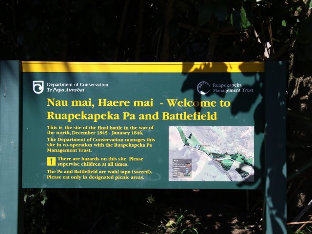
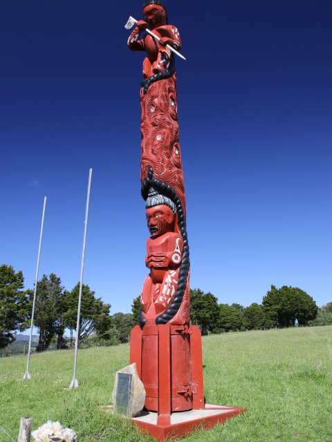
Assembled again on Ed, we headed to our next stop, about 40 minutes away. This was the sight of the last battle between the native Maori and the British forces. Not a really developed site, but one with great significance. The totem is an updated one, as the original is no more than a weathered post in the ground by now.
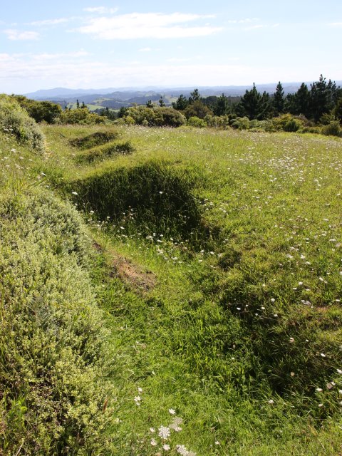
Last shot for today shows some of the trenches the Maori used in this battle. This is actually where the British learned about trench warfare, which would be so extensively used in World War I.
Another couple of hours on the bus brought us to our much appreciated stop for the night, the Pacific Rendezvous motel in Tutukata. We’ll be here for two nights, so I immediately unpacked everything and spread out. A lovely shower later had me feeling refreshed, but quite tired. Today was a lot of work!
Lina made dinner and let us know the plan for tomorrow. It’ll be kind of a rest-up day for all of us. We get to play in the water around Poor Knights islands. We’ll be taken out there on a boat with a bunch of other people to snorkel, kayak, and scuba. Lina will get us to the boat, then she has some time to rest and regroup as we’re in the hands of the boat cruise people for a few hours.
Tomorrow’s a relatively late start: 8:45! Because I was so tired after today’s activities, I came back after dinner and took a nap before starting work on this blog entry. It’s now 2 AM. I’m going to hit the sack and decide in the morning what to take for the day. It’s nice to not have to pack up in anticipation of heading out to another hotel tomorrow. But this trip is coming to an end. When I pack up tomorrow night, it’ll be with the flight home in mind. Wow, hard to believe I’m going to be home soon.
But right now, there’s a day of fun in the water to look forward to–after a good night’s sleep! 🙂


You May Also Like