-
Big Bend 2024 (Day 2)
After a buffet breakfast, we headed out to the Davis Mountains Preserve. First, though, we stopped at an art installation by the side of the road just outside of Marfa. We had passed this on the way into town and I mentioned I’d like to get pictures if we could…so we did!
Now, Marfa is where the movie Giant was filmed. The stars were Rock Hudson, Elizabeth Taylor, and James Dean. What you see here are billboards in the shapes of scenes from the movie, including the very hotel we’re staying in, the Hotel Paradisio. If you look closely, you’ll see the car’s license place says, “GIANT.” The “rocks” right in front of the car were actually speakers playing music. Fun.
(You can click on the pictures to see a “gallery show.”)


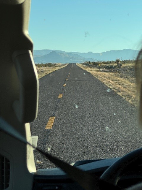
Then we headed into the mountains. These were two pictures from a moving van, so not the best. But it does show the road and the type of scenery we were seeing. It’s really quite beautiful country.


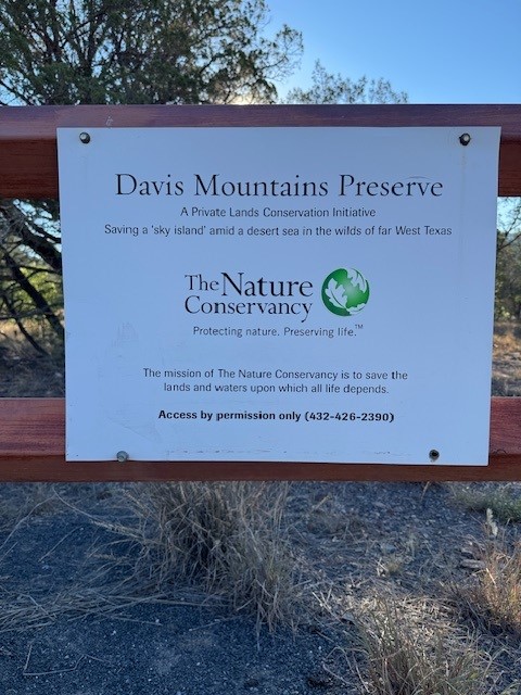
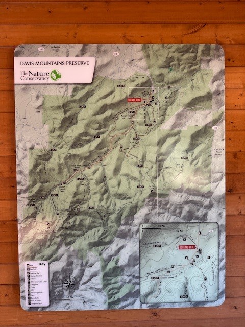
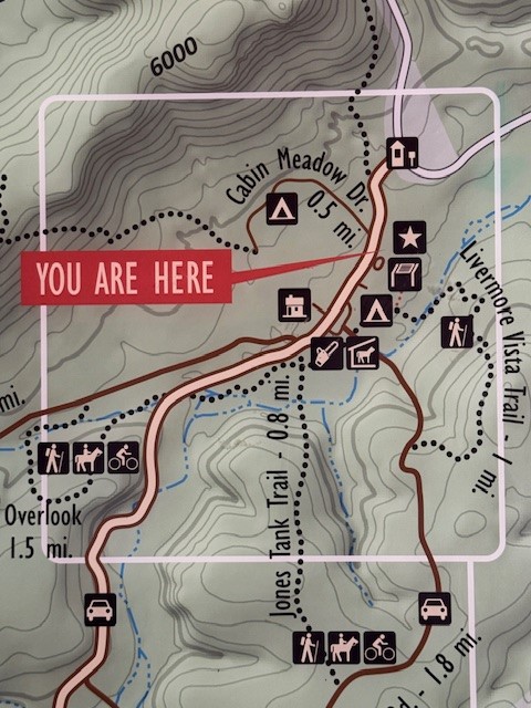
Our morning destination was the Davis Mountains Preserve, a property owned by The Nature Conservancy. Around this area, they also have conservation easement agreements with many surrounding properties. This allows them to preserve almost an entire watershed, which you can see on the topographical map.
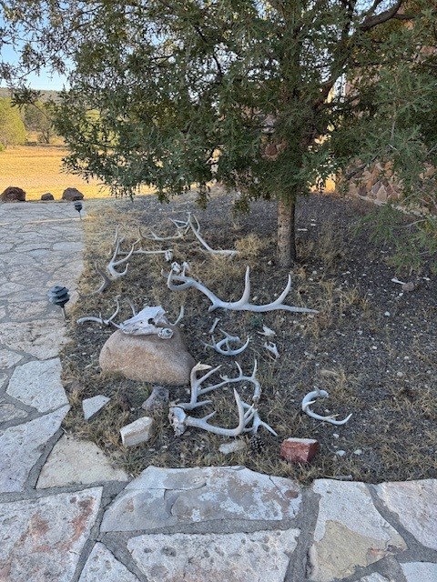
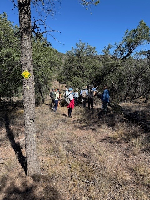
The horns are just outside the office where we got an orientation before heading out on a short-ish hike to an overlook, and then back.


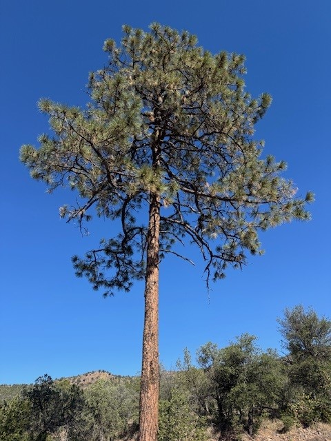
The tree is a Ponderosa Pine, one of two main types of pine trees in the area. The picture that looks like a brown field is actually from the overlook. On the right side of that “field” is the building where we started the hike.
Our group is 16 people in all. 12 guests, two Iconic Adventures guides, and two local (Texas-based) people from The Nature Conservancy. The group picture is on the way back down. Someone had spotted a lizard and everyone gathered around to have a gander. 🙂


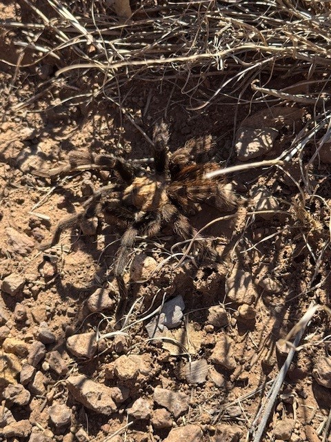
A big surprise was seeing a tarantula crossing the road in the middle of the day! He tried to hide in brush that looked like him. While he blended in well, someone poked at him and he moved away and up the side of the road. I got a great video, but it’s too large a file to incorporate now. Until I figure out how to do that, the static picture will have to do!

The hike was about 2 miles, I believe. We were pretty much all ready for a rest back at the office, where we also had lunch.
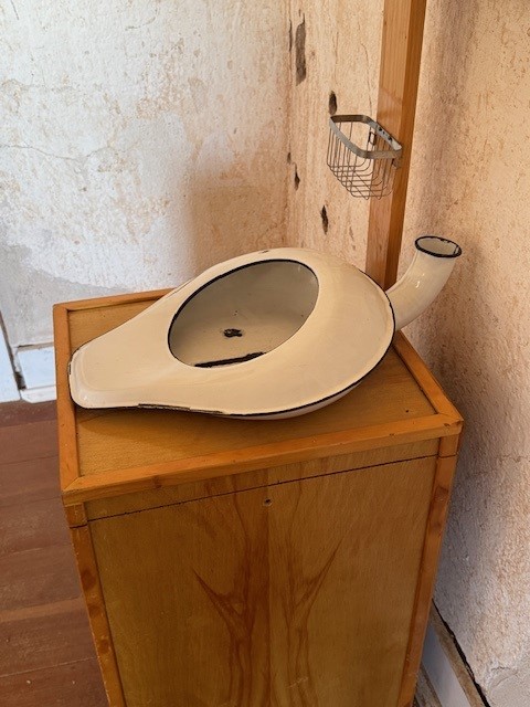
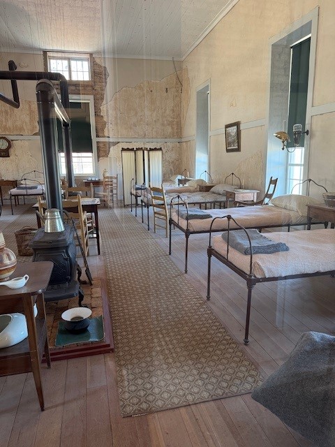
Our afternoon stop was at Fort Davis National Historical Site. I had never heard of this place, but it played a big part in the history of this area from 1854 until 1891. We saw a video that explained much of that, narrated by Kareem Abdul Jabar! There was a detachment of black soldiers here for many years, which I suppose is why they asked him to be the speaker. One of the outlying buildings was the fort hospital, which had two wards with 12 beds each. Some of it has been restored inside, so I got a few pictures. (The urinal just caught my fancy!)
The mountains were a great backdrop for the fort. I’m guessing they provided a certain amount of safety as the fort was not in an open field that could be attacked from all sides. The mountain formation is also really pretty. The row of buildings in the foreground is officers barracks. Enlisted men were in barracks in long buildings on the other side of the parade ground.


Then we headed back to Marfa for a rest and dinner. Both of our dinners here have been multi-hour affairs. Not sure if it’s our group size or something else, but service has been really slow, with long times between courses. But the company is good. We’re learning more about each other as time goes by. Maybe I’ll remember everyone’s names by the end of the week!
This is our last night in Marfa, until our final night. Tomorrow we pack up, load up, and head to Big Bend. We’ll visit a grassland along the way, but it seems like it’ll mostly be a travel day. Hope I can get everything back into my suitcase!